Engineer’s Line References (ELR) can be used to map areas along railway lines. They are used by Britain's national railway system to describe individual routes.
Step 1
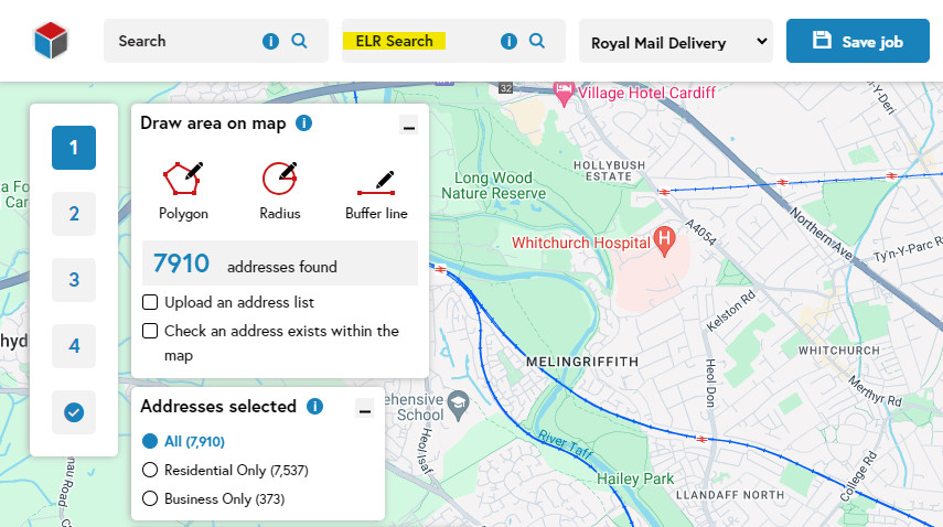
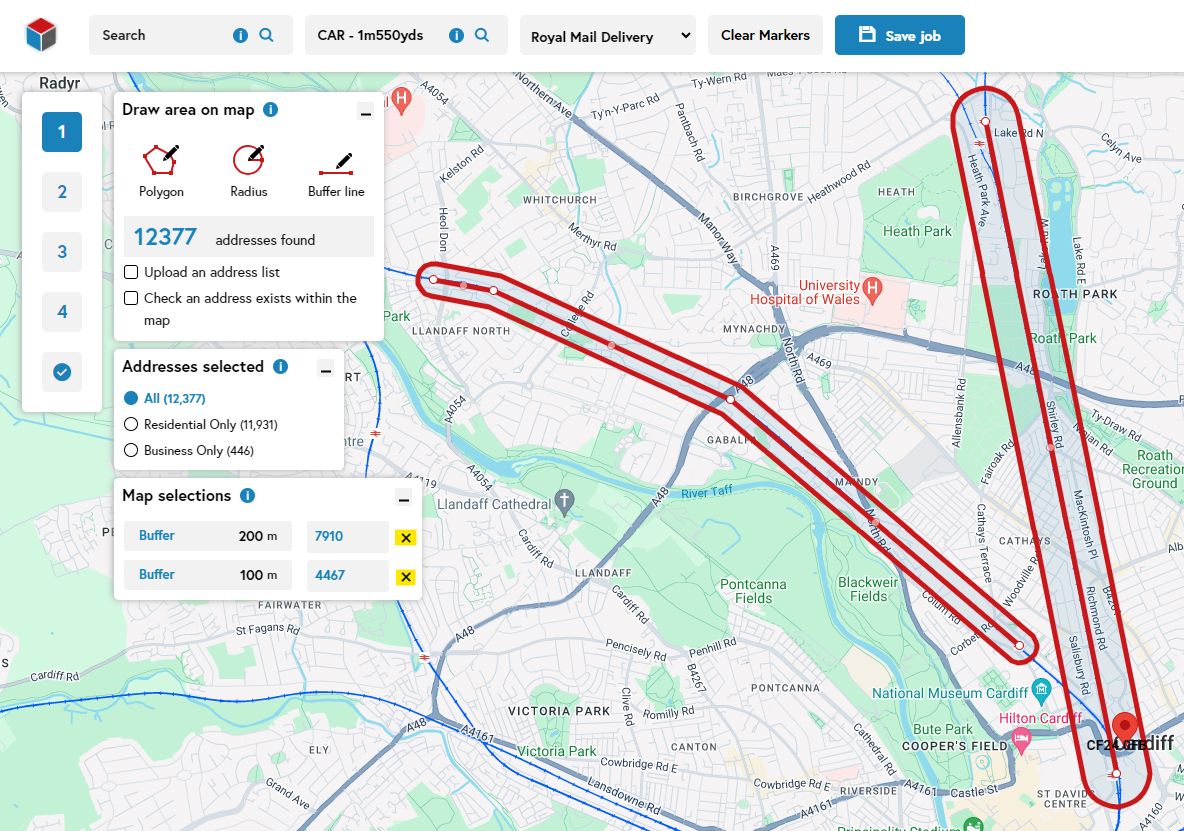
In the tellthem™ ELR search bar, start typing the relevant ELR code, e.g CAR. To refine the search, enter the distance along the route in the following format:
[ELR code][space][hyphen][space][mileage number][m][yards number][yds]. For example, CAR - 1m550yds.
‘CAR’ should always be followed with ‘ - ’, as above
‘1m’ refers to the mileage of the route
‘550yds’ – our search function measures in ‘yards’ rather than ‘chains’ – there are 22 yards in a chain
Step 2
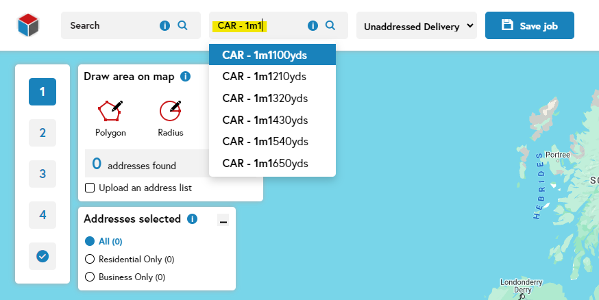
Once you start entering the route code, a drop-down menu of the possible ELR points will appear. This will continue to be refined as mileage and then yards are added. You can plot as many points as you like.
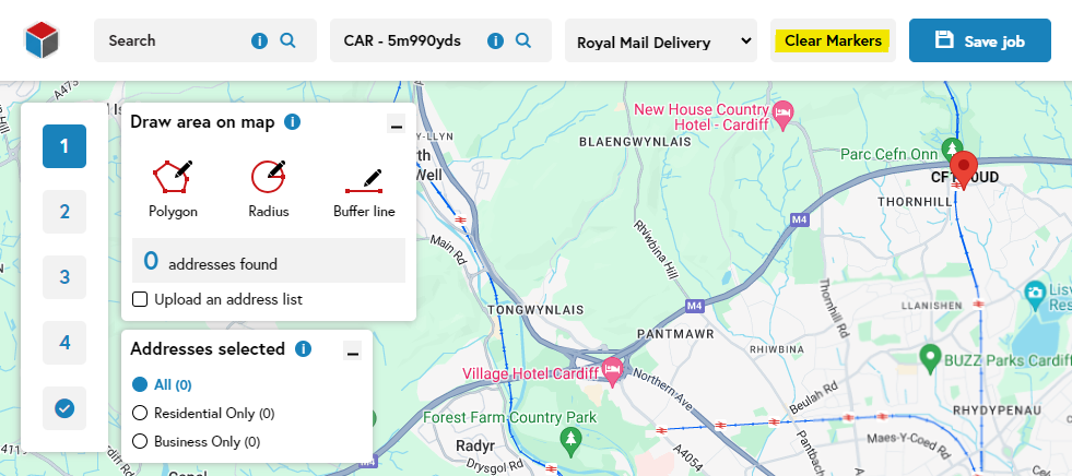
If you would like to start again, just click ‘Clear Markers'.
Step 3
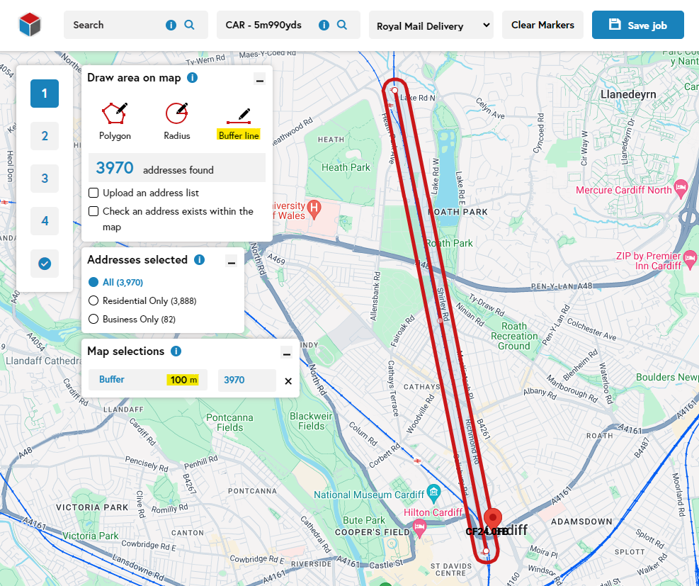
Use the 'Buffer line' tool to map your required area. The buffer will default to 200m either side of the line, but you can change it to any distance you like.
Step 4
To remove a buffer line, click the cross next to the buffer line you’d like to remove.
Related support guides
The search bar in tellthem™ accepts any term that you can use in Google Maps, including what3words.
Utilising Google Maps 3D or Street View enables you to better visualise the area you're mapping.


